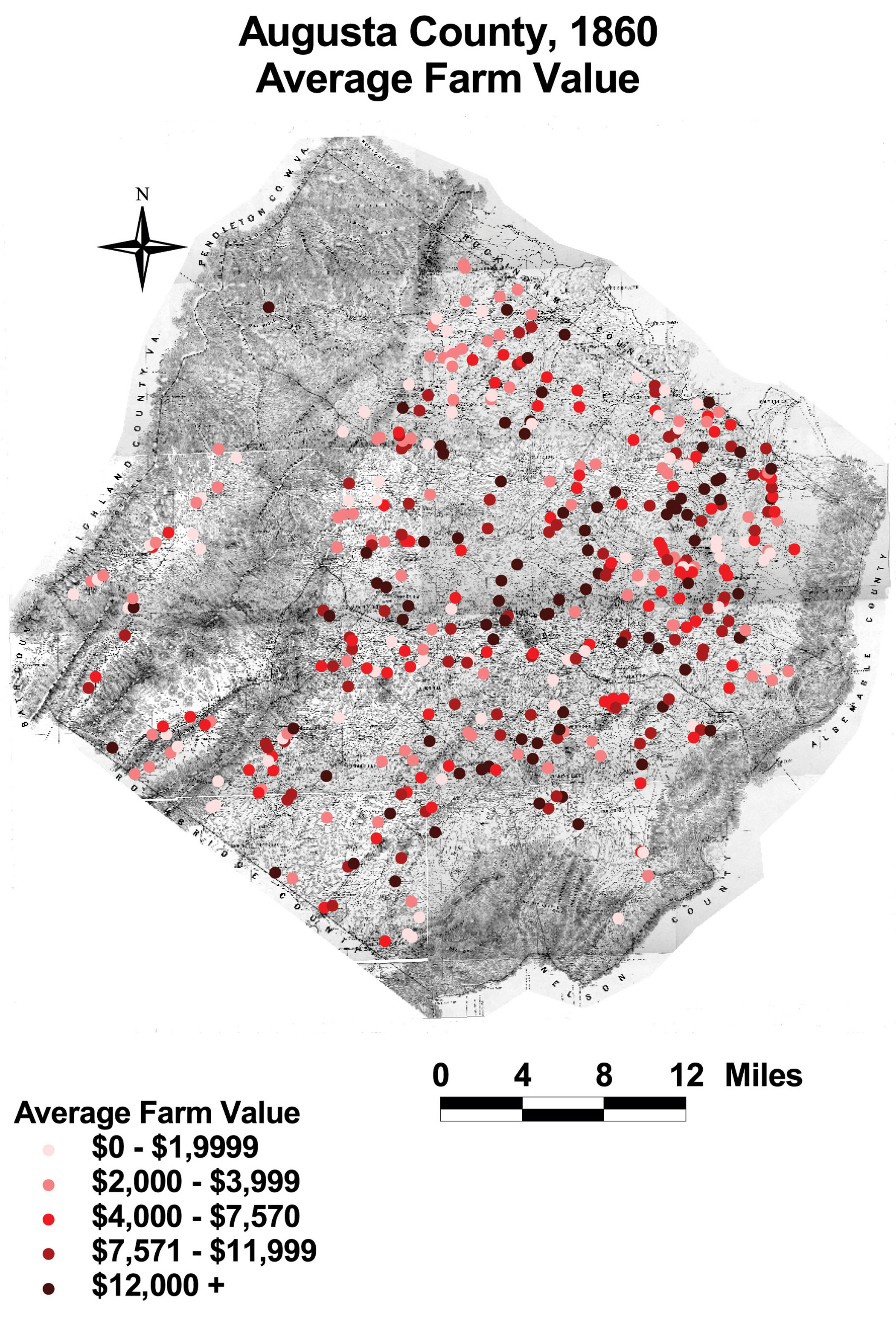
Augusta County: Average Farm Value, 1860
This map shows the distribution of farm values throughout the county. Farm values fluctuated throughout Augusta, with no one area dominated by the wealthy or poor.
Click on the map for a larger image.
The map is derived from a Jedediah Hotchkiss map of Augusta County, published in 1870 and based on surveys completed "during the war." The Hotchkiss map has been georeferenced at the Virginia Center for Digital History, using ESRI Arc Info to produce a Geographic Information Systems map and database of households.