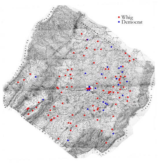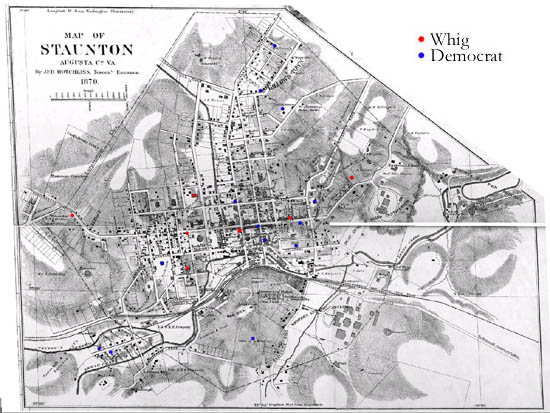
Augusta County: Party Affiliation in Augusta and Staunton
This map shows where local political party leaders (as identified in the newspapers) resided in Augusta County. While both Whigs and Democrats lived throughout the county, Whigs outnumbered Democrats in Augusta and were particularly well-represented in the county seat of Staunton.
The maps are derived from a Jedediah Hotchkiss map of Augusta County, published in 1870 and based on surveys completed "during the war." The Hotchkiss map has been georeferenced at the Virginia Center for Digital History, using ESRI Arc Info to produce a Geographic Information Systems map and database of households.