
Franklin and Augusta: Presidential Voting by Precinct, 1860
These maps compare 1860 presidential voting by precinct in Augusta and Franklin. Bell's overwhelming victory in Augusta overshadows subtle electoral patterns in the Douglas-Breckinridge-Bell split. The Democratic candidates together captured significant votes in Staunton and in the eastern and northern parts of the county, the broad middle part of the Valley just east of Staunton. In Franklin, Lincoln's support came from the broad middle of the county, centered in places with visible African American populations, such as Southampton, Montgomery, and the South Ward of Chambersburg.
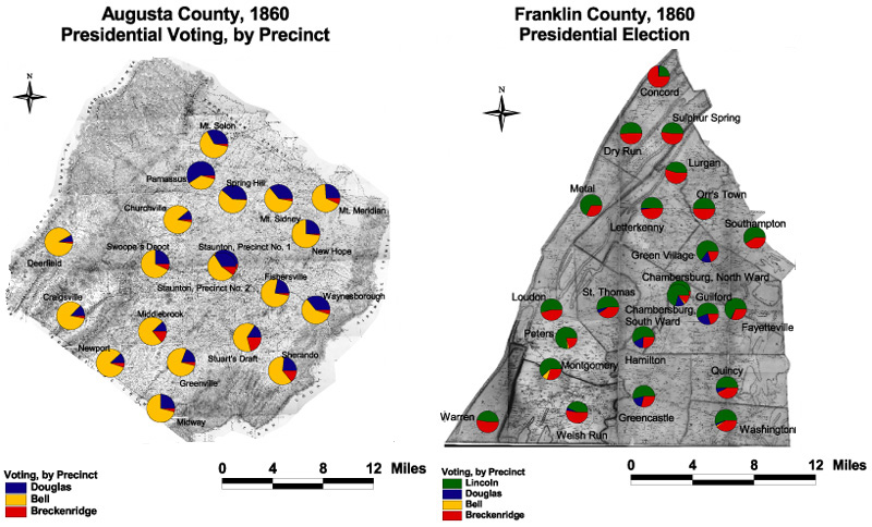
The maps are derived from a D. H. Davison map of Franklin County, published in 1858 and a Jedediah Hotchkiss map of Augusta County, published in 1870 and based on surveys completed "during the war." The maps have been georeferenced at the Virginia Center for Digital History, using ESRI Arc Info to produce a Geographic Information Systems map and database of households.