
Franklin and Augusta: Railroads and Roads, 1860
This map set compares the rail and road development in both counties, showing a highly networked infrastructure in both places. Franklin's greater density of major roads was offset by its truncated Cumberland Valley Railroad, which made Chambersburg its terminus in the late 1830s. Franklin's railroad effectively ended at Chambersburg, since its southern extension was too old and light to handle significant traffic. Augusta's line, The Virginia Central, by contrast, extended through the county south to Covington and there linked up with other roads connected to the South.
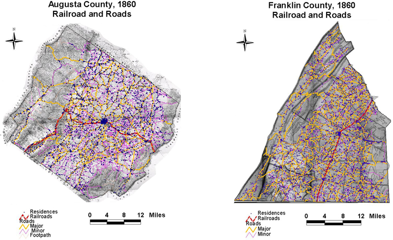
The maps are derived from a D. H. Davison map of Franklin County, published in 1858 and a Jedediah Hotchkiss map of Augusta County, published in 1870 and based on surveys completed "during the war." The maps have been georeferenced at the Virginia Center for Digital History, using ESRI Arc Info to produce a Geographic Information Systems map and database of households.