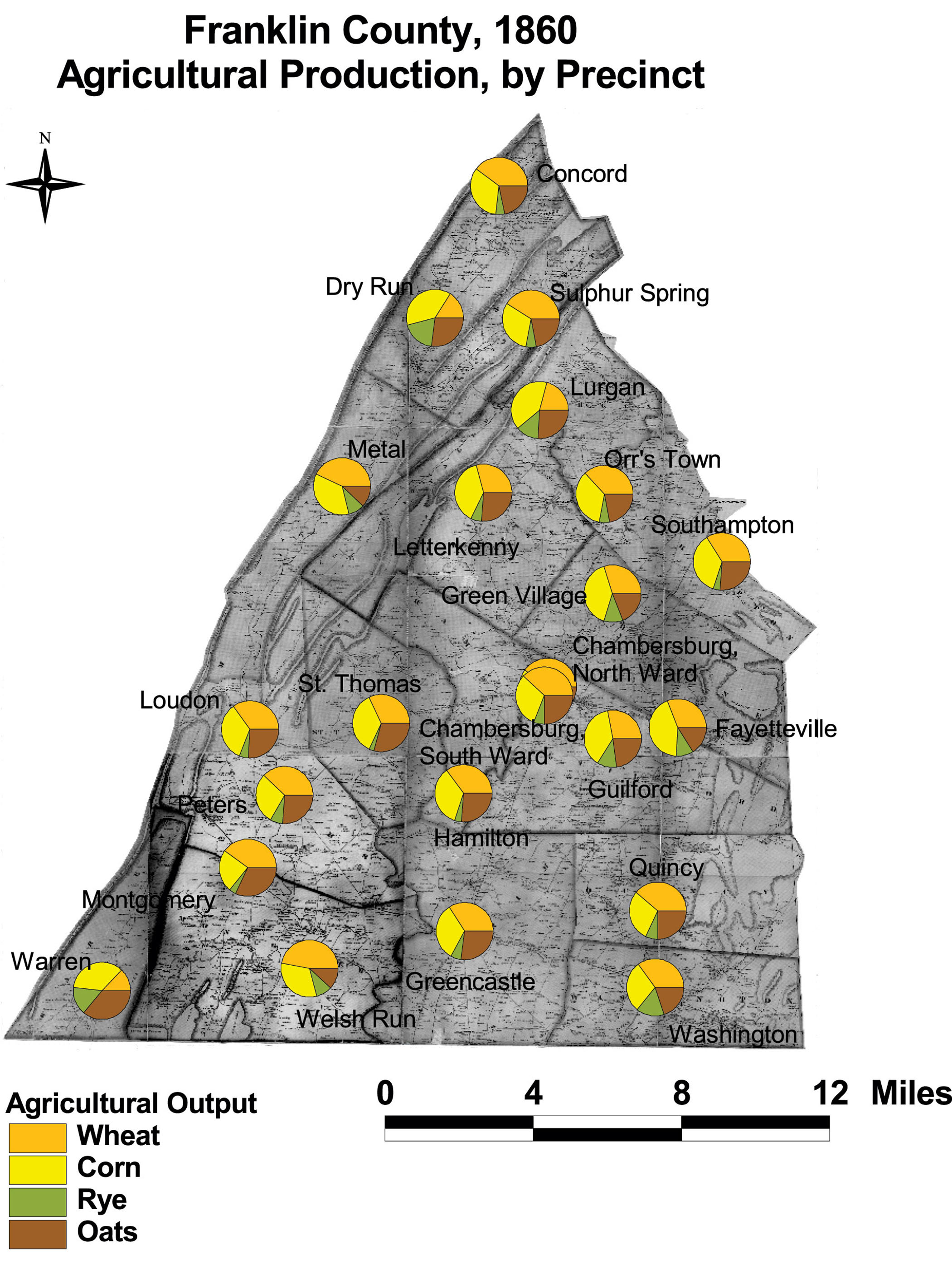
Franklin County: Agricultural Production by Precinct, 1860
Franklin County's agricultural production by voting precinct shows the diverse mix of Franklin's farms. The county grew mainly wheat, but significant amounts of rye as well. Dry Run, Lurgan, Concord, and Warren precincts stand out from the other precincts by their higher level of corn production and lower level of wheat production.
Click on the map for a larger image.
The map is based on GIS data and soil type data derived from a 1978 U.S. Geological Survey soil map. The map is derived from a D. H. Davison map of Franklin County, published in 1858. The Davison map has been georeferenced at the Virginia Center for Digital History, using ESRI Arc Info to produce a Geographic Information Systems map and database of households.
Note: Original precinct boundaries are not available. Precinct boundaries were established in the GIS using Thiessen polygons around precinct stations as central places.