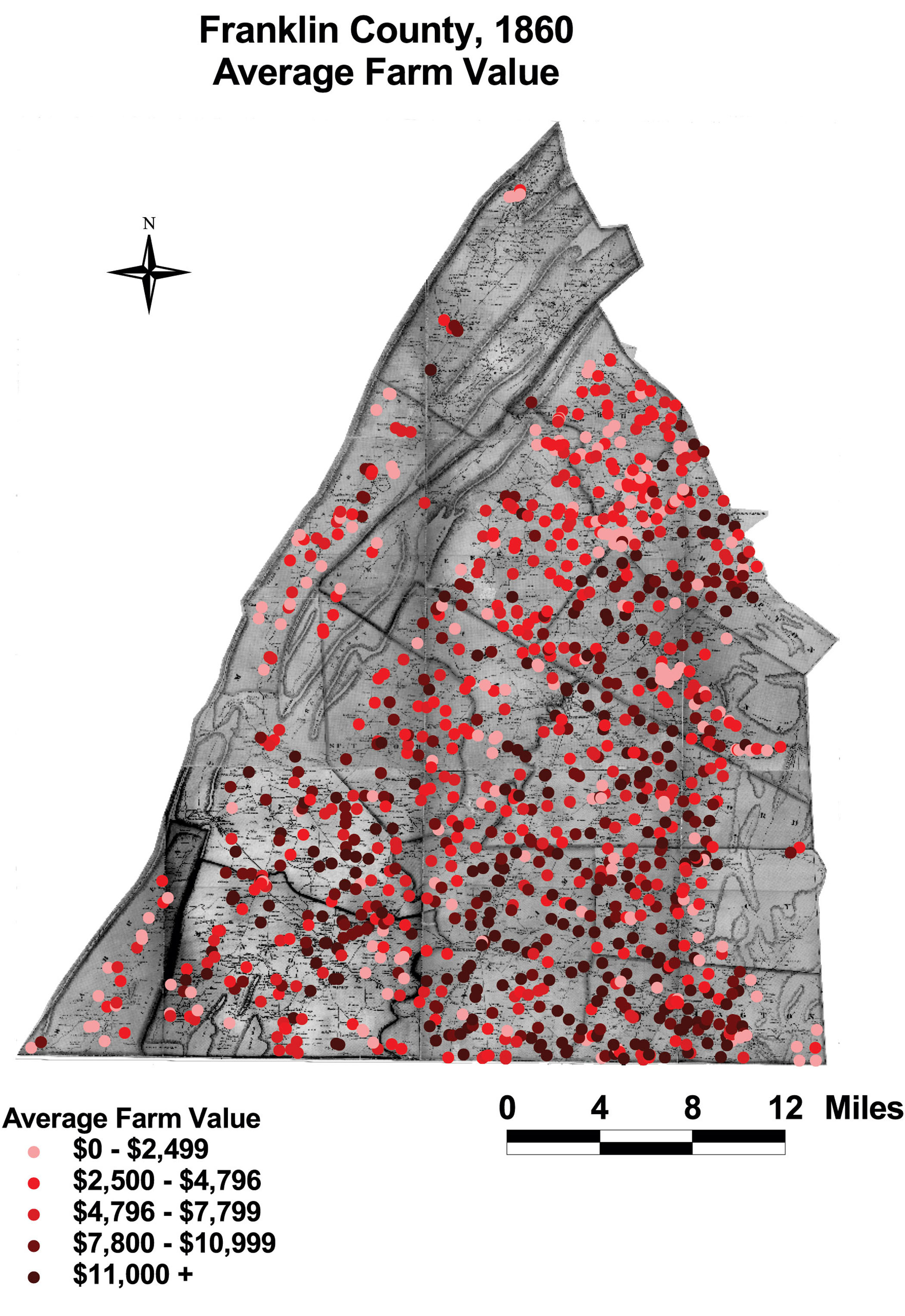
Franklin County: Average Farm Value, 1860
This map shows the wide distribution of farm values throughout the county. Franklin had higher land values than Augusta, but the wealth was spread out thoroughly in the county.
Click on the map for a larger image.
The map is based on GIS data and soil type data derived from a 1978 U.S. Geological Survey soil map. The map is derived from a D. H. Davison map of Franklin County, published in 1858. The Davison map has been georeferenced at the Virginia Center for Digital History, using ESRI Arc Info to produce a Geographic Information Systems map and database of households.